
The Hudson River 50 and Trail Marathon Courses
The 50 Mile and marathon courses offer a scenic tour through the the Palisades Interstate Park. The 50 mile course consists of two twenty-five mile loops, that start at the Ross Dock Picnic area and take runners all the way up to the New York State line and back. The trail marathon follows an almost identical course with some tack ons at the start and finish.
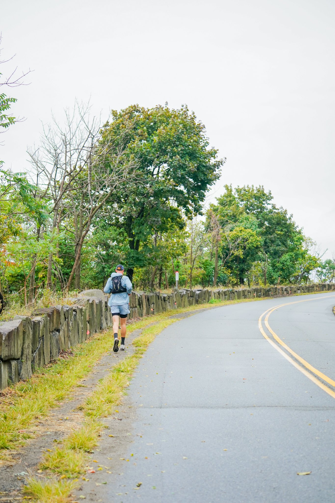
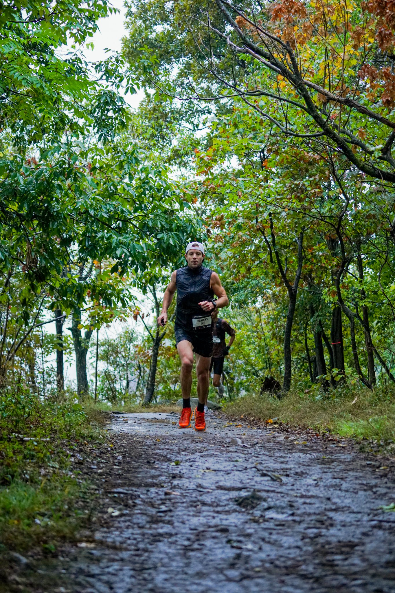
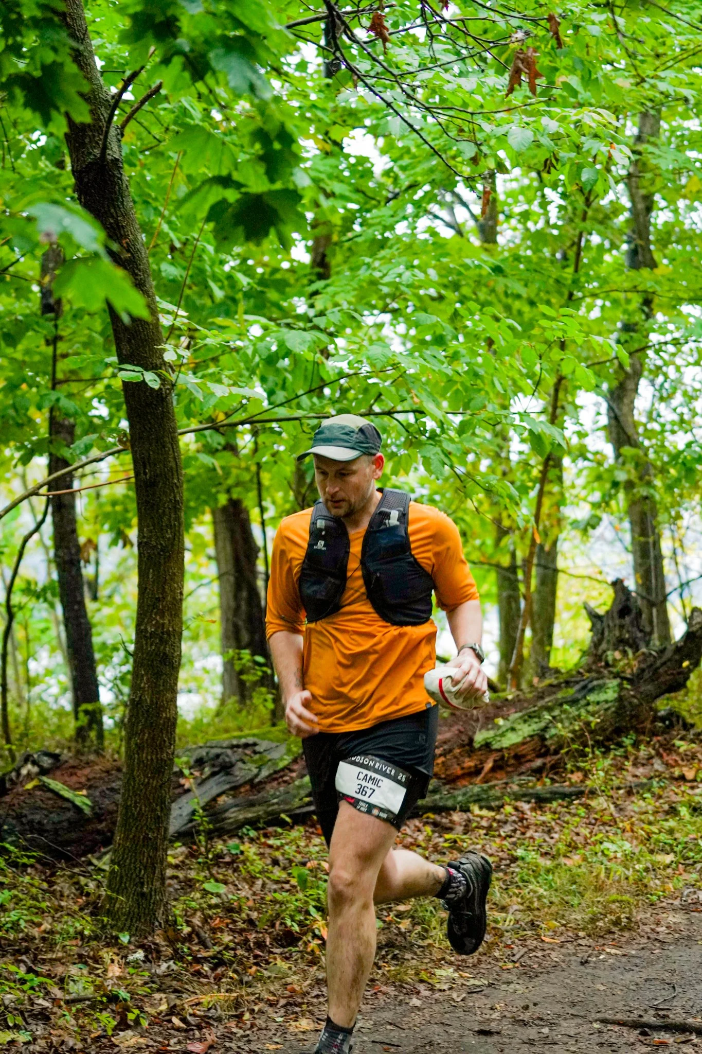
The trails feature a variety of surfaces types, primarily rocky semi-technical singletrack mixed with more smooth dirt singletrack. The course is generally runnable, with lots of twists and turns, hills of various sizes, and some rocky technical sections. There are some extended, intermittent sections of road shoulder and roads that connect some trail segments. Full details can be found below.


Detailed Course Description
The 50 mile loop consists of two 25 Mile Loops detailed below. The Marathon course will be almost identical with a short tack on at the start and finish at the Ross Dock Picnic area.
Start: Each loop starts and finishes at the Ross Dock picnic area. At the start runners will proceed south towards the George Washington Bridge, and do a small out-and-back just past the bridge. They will then turn around, retracing their steps, before taking a sharp left hand turn onto the trail that will take them up to the Long Path. This roughly 1/2 mile long hill is the second hardest climb on the course.
Miles 1.8-8.5: Once runners reach the top of the climb they will proceed north on the Long Path for roughly seven miles. These seven miles are primarily on single track trails and cross a few small roads. There are a few sections that are worth paying attention to below…
Allison Park Road (2.2 Miles): At around mile 2.2 (1 mile after hitting the top of the hill) runners will exit the trail onto a small road. Please proceed straight along this road for roughly .4 miles (keeping the highway to your left) the entire time. It is possible that you could see a car or two on this road so stay to the side and follow the orange markers.
Mile 3: Around mile 3 you briefly exit the trail again, turn right (staying on the grass) and cross the street in front of the grass and immediately re-enter the trail.
Mile 8.8: Around mile 8.8, just before hitting the Alpine Police Station, runners will leave the Long Path and head down the Closter Dock Trail. This trail drops about 360 feet and takes runners down to the Shore Trail just past Alpine Marina. (Please Note: This is the one major deviation from last year’s course!)
Mile 9.3 - 11.3: For the next two miles runners will continue along the Shore Trail. This section is largely flat, with a few small rolling hills. Footing is generally pretty good.
Mile 11.5 -12.2: Just after mile 11 runners will encounter the biggest climb on the course. This climb is hard and steep with over 500 feet of elevation gain in less than a mile. Runners will take this hill all the way up the hill to the Old 9W Road where they will hit the second aid station.
12.5-14.5: Just after the aid station runners will cross State Line Road and will make an immediate left onto Trail B. Runners will follow Trail B, to Trail A, to Trail C to Trail D (rest assured this will be well marked and easy to follow!) until they hit the paved Old 9w Road. You will then RIGHT onto Old 9w and proceed for roughly 1/3 mile before making a hard left back onto Trail E. Take Trail E up to the top of the hill, turn right at the intersection and proceed back down to Old 9W Road.
Miles 14.5-15.0: For the next half mile runners will stay along Old 9W/Station Road all the way back to the Aid Station (where the crossed the road earlier). There are no cars for the first stretch of this pavement, but then you’ll pass through some boulders and it will become an active roadway. Stay on the gravel shoulder until you get back to the entrance to the trails.
Mile 15-15.5: Once runners pass through the old 9W aid station (for the second time), runners will head back town the trail (the same way they came up) retracing their steps for roughly 1/4 mile. After 1/4 mile runners cross the small green bridge and make a right heading back up a short hill to the Long Trail. (After crossing the bridge DO NOT GO DOWN THE HILL! This is another change from last years course!)
Mile 15.5 - 17.5: For the next two miles runners will proceed south along the Long Trail. This section is generally pretty runable, although there are a few rocky sections that may require caution.
Mile 17.5: At Mile 17.5 runners will again leave the Long Path and head down the head back down the Closter Dock Trail for the second time. Again this trail drops about 360 feet and takes runners down to the Shore Trail just past Alpine Marina.
Mile 17.8 - 18.0: Around mile 18 runners will reach the bottom of the Closter Dock Trail, and will proceed south through the Alpine Marina, and onto the Shore Trail.
Mile 18.0-25.0: For the next 7 miles runners will stay along the Shore Path. This path is a mix of hard packed dirt trail, technical single track, and roads. Runners will follow this trail all the way back to the Ross Dock Picnic area. There are some twists and turns and some sections that get very rocky, but you should follow the course markings and stay on the trail along the water the entire way.
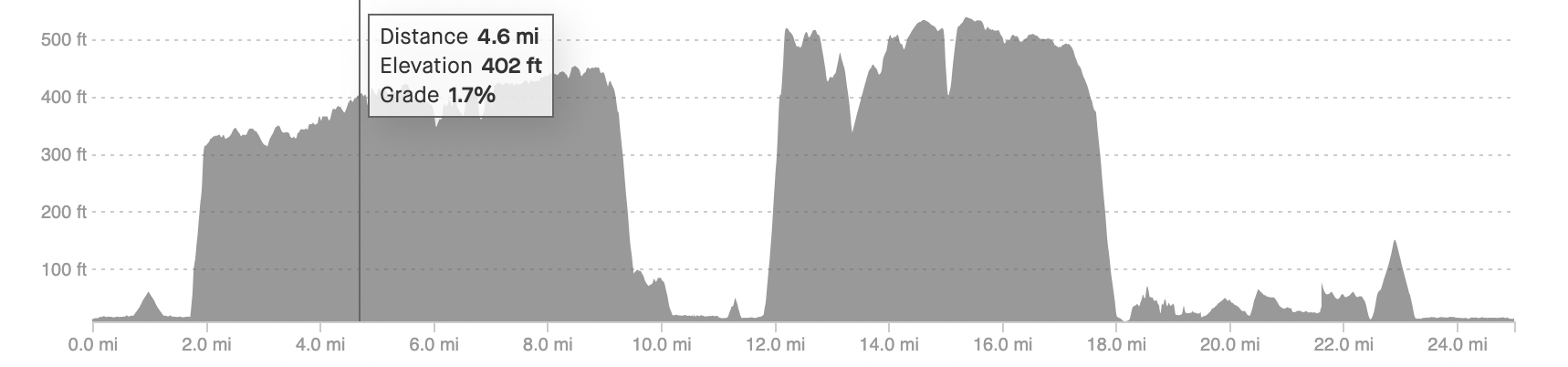
Each 25 mile loop has about 2,200 feet of total elevation gain.
Please note that the course has been updated since this video was recorded, however the trails are still the same and this should give you a good idea of the flow of the course.


Aid Station Locations
We have also made some changes to the aid station locations. This year there will be two aid stations out on the loop (and a third aid station at Ross Dock). Runners will pass through both of these aid station locations two times. The first/fourth aid station on the course will be located just off the parking lot at the Palisades Interstate Park Administrative Offices. Runners will hit this aid station just before they drop down onto the Shore Trail on the way out (around mile 9) and on the way back (around mile 17). The second aid station will be located on State Line Lookout Road and runners will pass by it around mile 13 and mile 15 of the loop. (This aid station is in the same location it was located in last year.) Crews are free to access these aid stations, and both aid stations will be stocked with water, gels, bars, and a variety of food options.
-
The first and fourth aid stations will just off the parking lot at the Palisades Interstate Administrative Office on Henry Hudson Drive. Runners will pass through this aid station around mile 9 and 17. There will be water, bars, gels, and a mix of some hot and cold food. There is a small parking lot close by and crews and pacers are welcome to stop here.
-
The second (and third) aid station is located at the intersection of State Line Lookout/Old 9W and the Long Path. Runners will hit this aid station around mile 13 and again at mile 15 (right before they turn off the road and head back into the trails).
Crews are welcome to meet with runners at this aid station. However, crews must use the State Line Lookout Parking Lot and walk to the aid station. Crews CANNOT park on the side of the road next to the aid station.
-
There will be a small aid station at Ross Dock that 50 milers who are coming through halfway can take advantage of. There will be some hot food and beverages.